Madagascar's limestone tsingy
Forests of stone, where rain has carved limestone into a maze of blades and canyons. Every massif is an island, and the plants that grow on the rock are among the most localised, and most endangered, on Earth.
- The tsingy are limestone karst: Jurassic limestone dissolved by rain into forests of razor-sharp pinnacles up to 40 m tall.
- The Tsingy de Bemaraha was Madagascar's first natural UNESCO World Heritage site (inscribed 1990); the Ankarana is the other great massif.
- The pinnacles isolate the landscape into thousands of microhabitats, driving micro-endemism: at Bemaraha ~85% of ~430 recorded plant species are endemic.
- The signature plants are succulents, above all Pachypodium (Madagascar holds ~20 largely endemic species), set within western dry deciduous forest.
- The western dry forest is among the most threatened biomes in Madagascar, and the showiest succulents are dug up for the illegal ornamental trade.
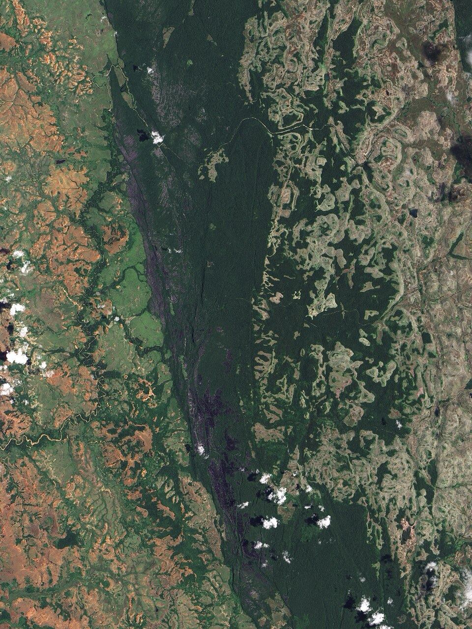
The word tsingy is usually translated as "where one cannot walk barefoot", and it is a fair warning. The tsingy are fields of limestone eroded into forests of pinnacles, blades and needles, some of them forty metres tall, separated by deep shaded canyons. From the air they look like a grey stone version of the forest they replaced. Up close they are one of the strangest plant habitats on the planet, and one of the richest in species that live nowhere else.
Two great tsingy massifs dominate western Madagascar: the Tsingy de Bemaraha, inscribed in 1990 as the country's first natural UNESCO World Heritage site, and the Ankarana in the north. What makes them matter to botany is not only the drama of the rock but what the rock does to life: it breaks a landscape into thousands of tiny, walled-off worlds, and isolation, as everywhere in Madagascar, breeds endemism.
Species and endemism figures for Bemaraha follow the UNESCO / IUCN World Heritage evaluation. Endemism at a single massif can run higher than the island-wide average because so many karst plants are confined to one site.
How the stone forest formed
The tsingy begin as a thick bed of Jurassic limestone, laid down when this part of Madagascar lay under a shallow sea. Uplifted and exposed, the limestone met the one thing it cannot resist: rain. Slightly acidic rainwater dissolves limestone along every crack and joint, widening them over millions of years into a lattice of fissures. The rock that survives between the dissolved channels is left standing as blades and towers, their tops sharpened to knife edges by continued rainfall, their bases undercut by water running below. The result is karst in its most extreme form, a surface almost impossible to cross and honeycombed beneath by caves and underground rivers.
A landscape of islands
This is where the geology turns into biology. A tsingy massif is not one habitat but thousands. The exposed tops of the pinnacles are baking, drought-stricken rock. The canyon floors between them are cool, shaded and comparatively moist, holding pockets of denser forest. The caves and fissures hold their own microclimates again. A plant established on one pinnacle or in one canyon is separated from the next by terrain that is, for a seed, almost impassable.
The effect is the same one that made Madagascar's whole flora distinct (set out in why Madagascar's flora is like nowhere else), but concentrated into a few square kilometres. Each massif, and sometimes each part of a massif, becomes an evolutionary island, and species diverge in isolation until many are confined to a single site. That is why endemism on the karst runs so high, and why losing even one massif can mean losing plants that exist in no other place on Earth.
The limestone does to a landscape in miniature what the ocean did to Madagascar: it turns one place into a thousand islands.
Plants that live on rock
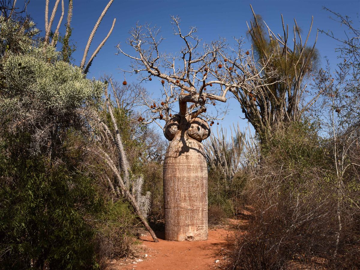
To survive on exposed karst a plant must handle drought, thin or absent soil, and fierce sun. Madagascar's answer, repeated across many unrelated families, is succulence: fat, water-storing stems and swollen trunks. The signature plants of the tsingy and the surrounding dry country are the Pachypodium, the "elephant's-foot" and bottle trees, swollen-stemmed relatives of the periwinkle. Madagascar is the world centre of the genus, with around twenty species, almost all of them endemic (Rapanarivo et al., 1999). Alongside them grow succulent Euphorbia, the climbing Adenia, aloes and wild vanilla clinging into the fissures.
Between and below the rock stands the western dry deciduous forest, dominated by Dalbergia rosewoods, Commiphora and Hildegardia, and by baobabs (Moat & Smith, 2007). These trees drop their leaves through the long dry season to survive months without rain, greening again only when the rains return. It is a flora built entirely around the management of water, and it is unlike anything in the wet forests of the eastern escarpment.
One of the most threatened biomes on the island
The western dry forests are among the most threatened habitats in Madagascar. They are easier to clear and to burn than the wet eastern forests, and the six decades of national forest data assembled by Vieilledent and colleagues show the dry west losing cover and fragmenting steadily (Vieilledent et al., 2018). The karst itself is a partial refuge, because the terrain resists cattle, fire and the axe, which is part of why so much survives on the tsingy while the forest around it thins. But the plateau plants face a threat the forest does not: collection. The showiest succulents, Pachypodium above all, are dug up for the international ornamental trade, and many are now listed under CITES to control it.
Because so many karst plants are confined to one massif, the custody question becomes acute. Across Madagascar, 1,656 endemic species have a preserved specimen somewhere in the world but none in any national institution, and 537 are known from a single specimen anywhere on Earth. For a plant found on one tsingy and held only in a herbarium overseas, the digital record may be the only form in which its own country can study it.
Custody figures are computed from the IsoGentiX Flora dataset (reconciled to the WCVP backbone) and reflect what has so far been digitised and localised.
Decoding is protecting
A stone forest is a good place to see why documentation and protection are the same task. A Pachypodium recorded, named, georeferenced to its massif and assessed for extinction risk can be argued for, licensed against illegal collection, and defended when land use is decided. One known only as an unlabelled sheet in a distant drawer cannot. Mapping which plant lives on which rock, and returning that record to Madagascar in a form its own scientists can use, is exactly the work the IsoGentiX Flora Portal exists to do. Decode:Protect.
Common questions
What is the tsingy?
The tsingy are limestone karst formations in western Madagascar, eroded by rain into forests of razor-sharp pinnacles separated by deep canyons. The two largest are the Tsingy de Bemaraha and the Ankarana.
How did the tsingy form?
From a thick bed of Jurassic limestone. Slightly acidic rainwater dissolved the rock along its cracks over millions of years, leaving blades and towers up to 40 metres tall, honeycombed by caves and underground rivers below.
Why is plant endemism so high here?
The pinnacles break the landscape into thousands of isolated microhabitats. Plants diverge in isolation until many are confined to a single massif. At Bemaraha about 85 percent of the roughly 430 recorded plant species are endemic.
Is the tsingy protected?
Yes. The Tsingy de Bemaraha was inscribed in 1990 as Madagascar's first natural UNESCO World Heritage site, now part of the Andrefana Dry Forests.
Sources and further reading
- UNESCO World Heritage Centre. Tsingy de Bemaraha Strict Nature Reserve (inscribed 1990; now within the Andrefana Dry Forests). whc.unesco.org, source for the Bemaraha species and endemism figures.
- Moat, J. & Smith, P. (2007). Atlas of the Vegetation of Madagascar. Royal Botanic Gardens, Kew. The standard mapping of Madagascar's vegetation types, including the western dry forests.
- Rapanarivo, S.H.J.V., Lavranos, J.J., Leeuwenberg, A.J.M. & Röösli, W. (1999). Pachypodium (Apocynaceae): Taxonomy, Habitats and Cultivation. A.A. Balkema, Rotterdam. Madagascar as the centre of the genus, with ~20 largely endemic species.
- Antonelli, A. et al. (2022). Madagascar's extraordinary biodiversity: evolution, distribution, and use. Science, 378(6623), eabf0869. science.org
- Vieilledent, G. et al. (2018). Combining global tree cover loss data with historical national forest-cover maps to look at six decades of deforestation and forest fragmentation in Madagascar. Biological Conservation, 222, 189–197. sciencedirect.com
- Govaerts, R. et al. World Checklist of Vascular Plants (WCVP). Royal Botanic Gardens, Kew. powo.science.kew.org
- Catalogue of the Vascular Plants of Madagascar. Missouri Botanical Garden, MNHN Paris, Parc de Tsimbazaza and partners. efloras.org