Madagascar's coastal and littoral forests
Two systems shaped by salt and sand. On the east, a ribbon of humid forest on ancient dunes, now torn into fragments. On the west, mangroves that hold the coast and store carbon in their mud. Both are among the richest and fastest-shrinking habitats on the island.
- Littoral forest grows on ancient coastal sand down the east coast. Only about 10% survives, in small fragments (Consiglio et al., 2006).
- Those fragments hold roughly 13% of Madagascar's native flora, and over 25% of their ~1,535 plant species are endemic to the habitat (Consiglio et al., 2006).
- Mangroves sit mostly on the sheltered west and north-west coast. Madagascar holds about 2% of the world's mangroves (Jones et al., 2016).
- Mangroves lost a net ~21% (57,359 ha) between 1990 and 2010 (Jones et al., 2016), while storing large amounts of "blue carbon" in their soils.
- Littoral sands near Fort Dauphin carry ilmenite (titanium ore); the QMM/Rio Tinto mine sits on some of the last, richest fragments.
Madagascar's coast carries two of the island's most valuable plant communities, and both are built around salt. On the eastern side runs the littoral forest, a thin band of humid lowland forest growing on old, nutrient-poor sand within a few kilometres of the Indian Ocean. On the sheltered western and north-western side stand the mangroves, salt-tolerant trees rooted in tidal mud. They look nothing alike. One is a closed canopy of orchids, palms and hardwoods; the other is a low, grey-green fringe standing in the sea. What they share is that both are lowland, both are exposed, and both are disappearing faster than almost anything else on the island.
They matter out of proportion to their size. The littoral forest occupies less than one percent of Madagascar's land, yet a strikingly large share of the flora has been recorded there, and much of it lives nowhere else. The mangroves cover a larger area but a tiny fraction of the world total, and they do work no other habitat does: holding the shoreline together, storing carbon, and feeding the fisheries that coastal communities depend on. Losing either is not a local matter. It is the loss of species, of carbon, and of the coast itself.
Littoral figures follow Consiglio et al. (2006); mangrove figures follow Jones et al. (2016). Both are national estimates from remote sensing and herbarium data, and both carry uncertainty at the level of an individual bay or fragment.
The littoral forest: rich habitat on poor sand
Littoral forest is humid lowland forest that grows on ancient sand deposits, the raised beaches and dune systems laid down along the east coast over hundreds of thousands of years. The sand is porous and holds few nutrients, so the forest that grows on it is distinct from the wetter forest on the escarpment just inland. It is lower, often with a denser understorey, and it carries an unusual mix: humid-forest plants growing side by side with species better suited to dry, exposed ground. That blend of wet and dry taxa, packed onto a narrow coastal strip, is part of what makes the community so species-rich.
The numbers are hard to overstate. Consiglio and colleagues recorded around 1,535 plant species from Madagascar's littoral forests, roughly 13 percent of the island's entire native flora, on a habitat covering well under one percent of its area. More than a quarter of those species are endemic to littoral forest, meaning they are found in this community and no other. The reason is the same isolation-driven divergence that shaped the whole island flora, set out in why Madagascar's flora is like nowhere else, but concentrated by the linear, broken geography of the coast: each patch of sand is, in effect, an island within an island.
The threat follows directly from the geography. Littoral forest sits on flat, low, accessible coastal land, exactly the ground people want for rice, cassava, settlement and access to the sea. It is easy to clear and easy to burn, and the wood makes good charcoal. Consiglio and colleagues found that only about 10.3 percent of the original littoral forest remained, and that just 1.5 percent of what was left fell inside the protected-area network. What survives is not a continuous strip but a chain of small parcels, some only a few hectares, separated by farmland, savanna and villages. Extreme fragmentation is the defining feature of this habitat: when each remnant may carry a plant found in no other, clearing a single parcel can end a species.
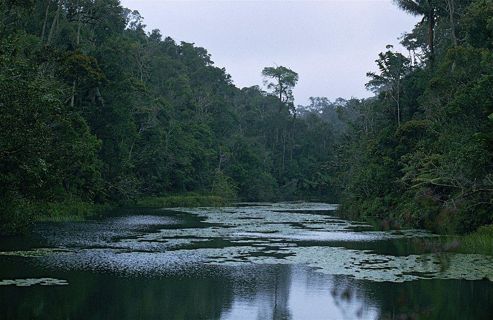
Thirteen percent of a nation's flora, standing on less than one percent of its land, and ninety percent of it already gone.
Ilmenite under the forest
The littoral forest carries a second threat the rest of the coast does not. The same coastal sands hold ilmenite, a titanium-iron oxide mined to make the white pigment in paint, paper and plastic. The richest deposits lie beneath the forest itself, near Fort Dauphin (Taolagnaro) in the south-east. Since 2009 the QMM operation, majority-owned by Rio Tinto, has mined ilmenite there, working a sequence of sites (Mandena first, then Sainte Luce and Petriky) that sit on some of the last and most species-rich littoral fragments on the island. Mining the ore means removing the forest above it.
The project was set up as a test case for the idea of a "net positive impact" on biodiversity: clear one area, but protect and restore enough elsewhere to end up ahead. An early forecast put the direct forest loss at around 1,665 hectares, about 3.5 percent of the roughly 47,900 hectares of littoral forest then thought to remain nationally (Temple et al. / BBOP, 2012). Whether the offset promise has been kept is contested, and independent observers have questioned both the biodiversity accounting and the mine's effect on nearby water. The honest position is that the litter of a global commodity, titanium dioxide, runs straight through one of the rarest habitats on Earth, and the tension between the two has not been resolved.
The mangroves: forests that stand in the sea
Round on the sheltered western and north-western coast, salt stops being an accident of the soil and becomes the whole condition of life. Mangroves are trees and shrubs that grow in the intertidal zone, rooted in soft, waterlogged, salty mud where almost nothing else woody can survive. Madagascar's are dominated by the Rhizophoraceae, the true mangroves such as Rhizophora and Bruguiera, alongside Avicennia, Ceriops, Sonneratia and others. They cluster in the deltas and bays of the west, where big rivers bring down sediment and the coast is calm enough for mud to settle. The country holds only a small share of the world total, about two percent, but that still makes it one of the more important mangrove nations in the western Indian Ocean.
Living in salt water demands machinery no inland tree needs. Mangroves exclude most salt at the root, filtering it out as they draw water in, and shed the rest through the leaves or into old leaves that then drop. Their roots face the opposite of drought: waterlogged mud holds almost no oxygen, so many mangroves breathe through aerial roots. Rhizophora throws down arching prop roots that lift the trunk clear of the tide; Avicennia sends up fields of pencil-like pneumatophores that stand above the mud like a bed of nails. Many are viviparous, the seed germinating while still on the parent tree into a long, dagger-shaped propagule that drops and plants itself, or floats off on the tide to root elsewhere.
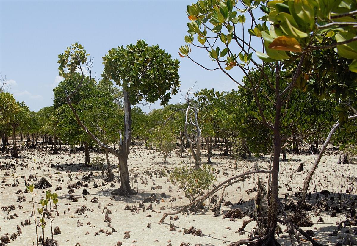
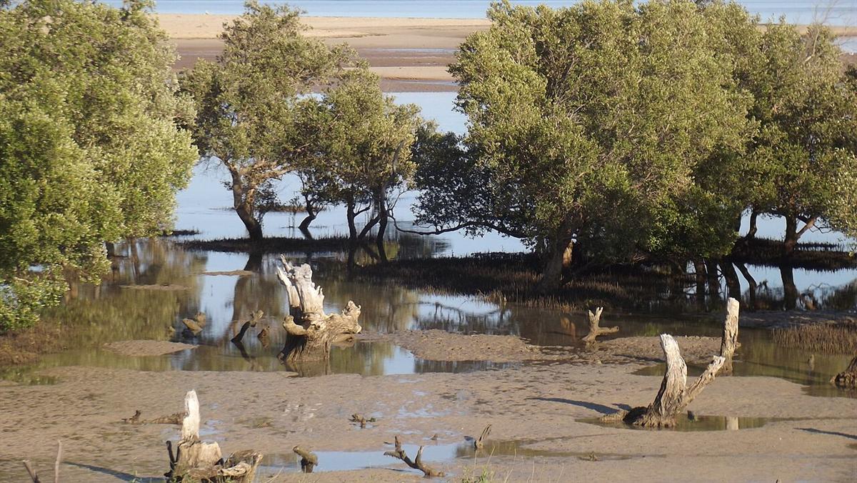
Mangroves store carbon at rates far above most terrestrial forest, and most of it is not in the wood but in the mud. Waterlogged, oxygen-poor soils slow decay, so leaf litter and roots build up over centuries as deep, carbon-rich peat. This "blue carbon" is why mangrove loss is doubly costly: it removes a living forest and, when the mud is drained or dug out, releases carbon that took hundreds of years to bury.
That is the second reason mangroves matter beyond their species list. They are among the most carbon-dense forests on Earth, they break the force of storms and cyclones before they reach the shore, they trap sediment and hold the coastline against erosion, and their root tangle is the nursery for the fish, crabs and prawns that feed and employ coastal villages. A mangrove is infrastructure as much as it is habitat.
Two systems, one direction of travel
Both coastal forests are shrinking, and for related reasons. The mangroves are cut for timber, for construction poles and above all for charcoal, and cleared outright for rice paddies and shrimp aquaculture. Jones and colleagues, mapping the whole coast from Landsat imagery, found a national net loss of about 21 percent, some 57,359 hectares, between 1990 and 2010, with the pace differing sharply from one bay to the next. The littoral forest, as we have seen, is further gone still. The national picture of forest loss and fragmentation that Vieilledent and colleagues assembled from six decades of data applies to the coast as much as the interior, and on the coast the fragments are smaller and the pressure more direct.
| Littoral forest | Mangroves | |
|---|---|---|
| Where | Eastern coast, on ancient sand | Mostly western & north-western coast, in deltas and bays |
| Rooted in | Porous, nutrient-poor coastal sand | Waterlogged, salty tidal mud |
| Salt challenge | Exposure, wind and salt spray | Salt water at the root; no soil oxygen |
| Signature plants | Palms, orchids, mixed wet/dry hardwoods; high endemism | Rhizophoraceae (Rhizophora, Bruguiera), Avicennia |
| Main value | Concentrated plant endemism | Carbon storage, coastal defence, fisheries |
| Main threats | Clearance, charcoal, ilmenite mining | Charcoal, timber, rice and aquaculture |
Why the record matters on the coast
The custody problem that runs through the whole IsoGentiX dataset is sharpest here, because coastal habitats are where a species is most likely to vanish before it is properly known. Across Madagascar, 1,656 endemic plant species have a preserved specimen somewhere in the world but none held in any Madagascar institution, and 537 are known from a single specimen anywhere on Earth. A littoral endemic recorded from one fragment near a mine, or a mangrove associate known from one silting delta, can slip from "rare" to "gone" inside a single working lifetime. When it does, the digitised record may be the only form in which its own country can still study it.
Decoding is protecting
On a shrinking coast, the record is not a substitute for the forest, but it is often the difference between a species that can be argued for and one that cannot. A littoral endemic mapped to its fragment and assessed for extinction risk can be built into a protected area, weighed in a mining consent, or defended when land use is decided. A mangrove system whose extent and carbon are measured can be paid to stand rather than be cut. Returning that record to Madagascar, in a form its own scientists and agencies can use, is the work the IsoGentiX Flora Portal exists to do. Decode:Protect.
Common questions
What is littoral forest in Madagascar?
Littoral forest is lowland humid forest that grows on ancient, nutrient-poor sand within a few kilometres of the eastern coast. It once formed a near-continuous ribbon down the east coast. Only about 10 percent survives, broken into small fragments, yet it holds around 13 percent of Madagascar's native flora and more than a quarter of its species are endemic to that habitat.
Why is littoral forest so threatened?
It sits on flat, accessible coastal land that is easy to clear for farming, charcoal and settlement, and the same sands carry ilmenite, a titanium ore mined near Fort Dauphin. The forest is already reduced to scattered parcels, so clearing even one fragment can remove plants found nowhere else.
Where are Madagascar's mangroves and why do they matter?
Most of Madagascar's mangroves grow on the sheltered western and north-western coast, in deltas and bays. They hold roughly 2 percent of the world's mangroves. They store large amounts of carbon in their waterlogged soils, protect the shore from storms and erosion, and nurse the fish and prawns that coastal communities live on.
How much mangrove has Madagascar lost?
A national remote-sensing study found a net loss of about 21 percent, roughly 57,000 hectares, between 1990 and 2010, driven by cutting for timber and charcoal and by clearing for rice and aquaculture, with the rate varying widely between bays.
Sources and further reading
- Consiglio, T., Schatz, G.E., McPherson, G., Lowry, P.P. II, Rabenantoandro, J., Rogers, Z.S., Rabevohitra, R. & Rabehevitra, D. (2006). Deforestation and plant diversity of Madagascar's littoral forests. Conservation Biology, 20(6), 1799–1803. onlinelibrary.wiley.com
- Jones, T.G., Glass, L., Gandhi, S., Ravaoarinorotsihoarana, L., Carro, A., Benson, L., Ratsimba, H.R., Giri, C., Randriamanatena, D. & Cripps, G. (2016). Madagascar's mangroves: quantifying nation-wide and ecosystem specific dynamics, and detailed contemporary mapping of distinct ecosystems. Remote Sensing, 8(2), 106. pdxscholar.library.pdx.edu
- Temple, H.J., Anstee, S., Ekstrom, J., Pilgrim, J.D., Rabenantoandro, J., Ramanamanjato, J.-B., Randriatafika, F. & Vincelette, M. (2012). Forecasting the path towards a Net Positive Impact on biodiversity for Rio Tinto QMM. IUCN & Rio Tinto / Business and Biodiversity Offsets Programme (BBOP). forest-trends.org
- Vieilledent, G., Grinand, C., Rakotomalala, F.A., Ranaivosoa, R., Rakotoarijaona, J.-R., Allnutt, T.F. & Achard, F. (2018). Combining global tree cover loss data with historical national forest-cover maps to look at six decades of deforestation and forest fragmentation in Madagascar. Biological Conservation, 222, 189–197. sciencedirect.com
- Antonelli, A. et al. (2022). Madagascar's extraordinary biodiversity: evolution, distribution, and use. Science, 378(6623), eabf0869. science.org
- Callmander, M.W., Phillipson, P.B., Schatz, G.E., Andriambololonera, S., Rabarimanarivo, M., Rakotonirina, N., Raharimampionona, J., Chatelain, C., Gautier, L. & Lowry, P.P. II (2011). The endemic and non-endemic vascular flora of Madagascar updated. Plant Ecology and Evolution, 144(2), 121–125. plecevo.eu
- Moat, J. & Smith, P. (2007). Atlas of the Vegetation of Madagascar. Royal Botanic Gardens, Kew. The standard mapping of Madagascar's vegetation types, including littoral forest and mangrove.
- Govaerts, R. et al. World Checklist of Vascular Plants (WCVP). Royal Botanic Gardens, Kew. powo.science.kew.org
- Catalogue of the Vascular Plants of Madagascar. Missouri Botanical Garden, MNHN Paris, Parc de Tsimbazaza and partners. efloras.org